Sunday, 5 April 2015

Mayakafer – Saverne

In the morning, the window of our room provided a view of the clouds lifting and being replaced by much welcomed sunlight.

We left at 10.45 after a relatively sparse breakfast. We had a very quick look at the glass blowing shop up the road but decided it was probably not a good idea to buy artisan crystal souvenirs on a cycling holiday. We also waited about 10 minutes to take photos of the nearby boat-lift (plan incliné de Saint-Louis-Arzviller), but although there were a couple of boats around there didn't seem to be any up-and-down traffic.

After some challenging navigation we were back on the canal path by 11.30 where we were greeted with stunning views of Château de Lutzelbourg.

In the town underneath the castle we found an open bakery. We chose the station platform for a half-hour second breakfast where numerous TGV trains were passing at grande vitesse.

Further we went along the canal, much speedier than yesterday thanks to the downhill. At this point we crossed the border between the Lorraine and Alsace regions. This was our third day on bikes and should have been a rest day, so we only planned to cycle 20km to Saverne today.

We arrived at Saverne about an hour later and stopped for a little snack beside the youth hostel which was housed in the impressive central palace, but obviously closed for the Easter holidays.

Unable to find good accomodation online we headed toward the tourist information in the town centre which was also closed, but showed a list of gîtes on the door. We picked one right next to the canal and checked in just before 3 o'clock. The room had a questionable plastic-bedcover atmosphere and the gîte's owners subjected their guests to an elaborate list of rules and regulations.

We spent the afternoon walking up to Haut Barr castle and enjoyed great views of the northern Vosges hill-range through which we had come and the vast Rhine plains towards Strasbourg which lay ahead of us.

There was a restaurant in the castle at the top, but it wasn't serving food when we were there so we decided to return to the city for dinner. We found a restaurant which was recommended for its tarte flambée and made a reservation. It wasn't open for dinner yet, so we had some more time to look around Saverne's old town.

Back at the restaurant we had some Alsatian tarte flambée which is known well beyond the region. Even the dessert consisted of tarte flambée topped with fromage frais and a Japanese type of lime.

Saturday, 4 April 2015

Sarre-Union – Mayakafer

We had breakfast at our motel and then cycled up to the supermarket in the town centre to stock up on snacks for the day and emergency dinner.

At 10.30 we were on the road, heading back towards the canal. We returned to the traffic-free cycle path alongside it at Harskirchen after about 4km.

The clouds hadn't cleared during the night and the weather was varying between a drizzle and light rain. The canal meandered very much like yesterday and we reached Mittersheim on the shore of the like-named lake after about one hour.

We had already passed a number of locks on the canal today and they were becoming ever more frequent. A café next to the second lock in Mittersheim beckoned for a second breakfast or early lunch, but there was no food on offer so we just had some coffee and left after a brief 20 min break.

Just after Mittersheim the canal crosses several side arms of the Grand Étang de Mittersheim, providing unique views of cycling alongside water on top of more water. Several kilometres further on we crossed Les Trois Ponts where the canal cuts across lake Stockweyer.

We were soon passing along the shore of Étang de Gondrexange and reached the eponymous town at 2 o'clock.

We quickly toured the centre which was completely deserted and lifeless without any opportunity for lunch or even a snack. Luckily we had spotted a roadhouse or boathouse on the way in which was situated on the shore of the lake a small distance from the town itself. We found it to be open and containing a small shop and a restaurant, although the kitchen was currently closed. We had some sandwiches and coffee and stayed for about 70 minutes to get warm.

The only other customer in the shop was a very kind lady who offered to host us for the night, but we still intended to cover some distance today so had to decline.

It was nearly 3.30 when we left Gondrexange and we had phoned ahead to a very nice looking hostel called Auberge de Mayakafer that Lisa had found online, but which was still 30km ahead along the cycle path.

While we had been going roughly south since the start of our tour in Saarbrücken, our course turned east from this point and followed the Canal de la Marne au Rhin. The cycle path so far had been almost perfectly level except for the regular ramps alongside each of the locks. Unfortunately for Lisa, the path along the Canal de la Marne au Rhin followed the canal much less closely and was therefore noticeably more hilly.

Just after Niederviller, the canal disappears underneath a mountain and emerges again from a tunnel on the other side while the cyclists are required to go over the top.

The same happens at Arzviller from where the cycle path follows the Ancien Canal de la Marne au Rhin which becomes the beautiful Valle d'Ecluses, the »valley of the locks«. There are locks every few hundred metres, each with nice little lock-keepers' cottages that have been converted into picturesque homes.

The rain had stopped in the meantime, but it was only after another 3.5h of continuous cycling that we reached our Mayakafer hostel for the night, shortly before 7 o'clock. Today we had cycled 70km, most of them wet.

The hostel provided a very warm and welcoming atmosphere while having a distinctive, decidedly quirky style. We were offered a warm dinner by our friendly host who prepared a vegetarian meal for Lisa although it was obvious that this was a slightly unusual request.

Friday, 3 April 2015

Saarbrücken – Sarre-Union

We started at St Johanner Markt in central Saarbrücken at just after 1 pm. The cycle path follows the river Saar towards the French border. Here we crossed into France after less than half an hour's ride.

The cycle path continues on the French side of the river which forms the border to Germany up to Sarreguemines.

A little further along we reached a lock at Sarreinsming where we had a 30 minute break after about 2½h of cycling.

At this point the Canal des Houllieres de la Sarre rejoins the river, and from here our cycle path ran alongside the canal with the river on the other side.

Both the canal and the river meander in large bends in this region, so it takes a lot of cycling to cover what looks like a moderate distance on the map. Two hours after our first break we arrived at Sarrealbe at the junctions of the rivers Sarre and Albe. Here we intended to have a late lunch.

We quickly discovered that this was going to be much more difficult than we had anticipated for two reasons. Firstly, it was Good Friday and the French appear to be surprisingly strict about observing their holidays, so much so that even the restaurants remain closed. Secondly, the French are equally strict about observing meal times, so it can be very difficult to obtain food at 5 o'clock between the regular lunch and dinner times, like we did.

We found a café that was open, but »café« turned out to be the French word for »bar« and besides having a fairly inhospitable atmosphere served only beer, but no coffee.

Eventually we worked out that our only choice was the kebab and pizza shop we had first spotted on our way into town, so we ordered pizza and tea in order to warm ourselves and stayed for a little over an hour.

Having regained some strength and warmth, we asked at another café (i.e. bar) whether there was any hostel or hotel in Sarrealbe for us to stay. We were told the nearest one was in Keskastel about 5km further along the road. The cycle path did not run past any larger villages or towns for the next 20km, so we decided to leave Sarrealbe along the road to Keskastel. Cycling along the road was decidedly less fun than the traffic-free cycle path we had been using before. It was also beginning to get dark and some rain was settling in, so we were very glad to reach the hostel we had been recommended some 20 minutes later.

Unfortunately, it was booked out and there was no alternative in Keskastel. Instead, we were told that there were a couple of hotels as well as some holiday homes in Sarre-Union, another 4km along the same road. Left with no choice we kept riding for another 20 minutes until we passed a motel on the road into Sarre-Union. This place really didn't appeal to us, so we decided to have a look at the other hotels and the holiday homes that we had been told about.

We cycled up the hill towards the town centre and found another hotel which was closed, presumably for the Easter holidays. Just around the corner was the holiday flat which we could have rented, but decided it was really too big for us and a little too costly for just one night.

In the end, we rode back down to the motel that we had passed on our way in and rented a room at 7.30pm. Including the unforseen extension while looking for accomodation at the end we had cycled 53km today.

The room was a little cheesy and we didn't feel like we quite got our money's worth, but at least we had somewhere to dry off and get warm.

Sunday, 22 June 2014

Grömitz to marzipan capital Lübeck

The last day of the weddding festivities started with breakfast at Cismar monastery.

After breakfast I left Grömitz the way I had come, heading towards Lübeck. On the way into Lübeck I passed Bad Schwartau which is known throughout Germany for its jam production company of the same name.

Lübeck in turn is famous for its marzipan, so my obvious first stop was the Lübecker Marzipan Speicher located in a beautiful red-brick storehouse on the river Trave.

It was extremely windy in Lübeck as can be seen from the fountains in this picture.

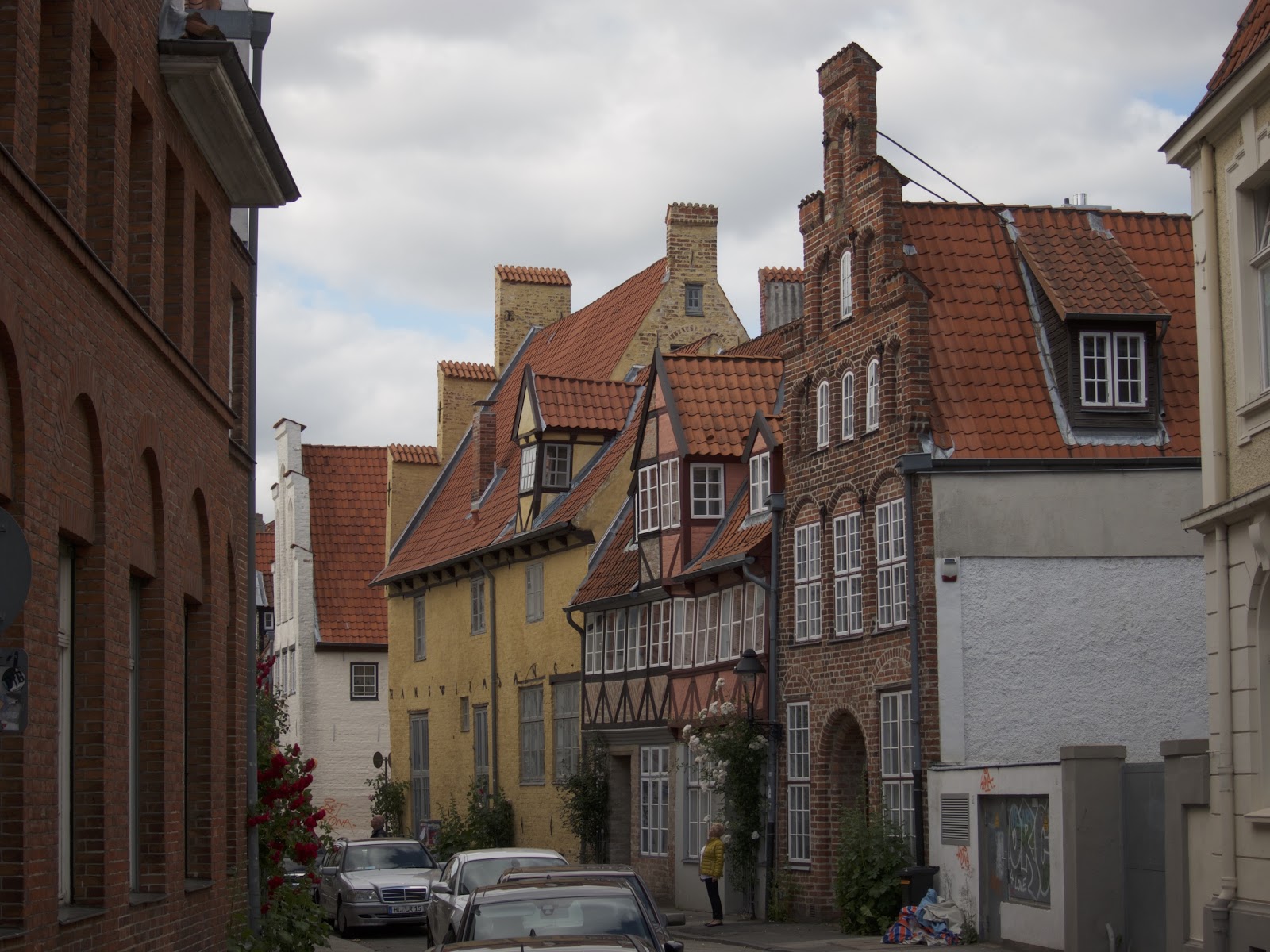
Lübeck boasts some impressive architecture in its island-like old town, including a large number of wood frame houses still intact even after two world wars.

Another well-known building is Lübecks' Holsten Tor just outside the old city wall.

Eventually I caught the train back to Berlin with one change in Bad Kleinen.

Wednesday, 18 June 2014

Berlin to Grömitz day three

Today's last etape lead via Travemünde to my destination at Grömitz. I left the camp site at 9 o'clock heading north.

After about 100 minutes I reached Grevesmühlen from the south-east, taking me past the station on my way to the centre. I was quite shocked when I saw the state of some of the buildings and roads. The area could most accurately be described as a slum. It was a cruel reminder of how run-down many parts of East Germany had become in 40 years of Communism that these wounds were still gaping even 25 years later.

Once I reached the old town of Grevesmühlen all of this was immediately forgotten as the area around the central square had been nicely renovated and looked quite touristy. I had an excellent, sumptuous breakfast at Café Flair by the market square opposite the town hall.

On the way I came across an old railway crossing. Even though there were no traces of the railway line, the boom gates had not been removed which looked rather odd.

A little later I had a quick stop for some lunch near Dassow.

At exactly 1 o'clock I reached Priwall, a suburb of Travemünde at the coast of the Baltic sea. I crossed the river Trave by ferry – the city's name translates literally as »mouth of the Trave«.

From now on my route would lead me parallel to the Baltic shore in a large arch towards Grömitz, a very touristy region. On the upside, this meant that there was an almost uninterrupted car-free cycle way, however it was so frequented by families and other holiday-makers that using the road was actually quicker.

In Sierksdorf the cycle path ended and I was back on the road. I arrived in Grömitz just after 3 o'clock, taking advantage of the fact that the local authorities had gone to the trouble of setting up a sign to point out the ideal location from which to view the Bay of Lübeck.

Today's ride had been 95km, taking my total up to 340km, slightly less that the distance given on an old milestone alongside Berlin's heraldry.